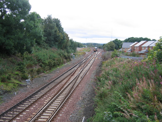
Polmont Junction
Introduction
The photograph on this page of Polmont Junction by A-M-Jervis as part of the Geograph project.
The Geograph project started in 2005 with the aim of publishing, organising and preserving representative images for every square kilometre of Great Britain, Ireland and the Isle of Man.
There are currently over 7.5m images from over 14,400 individuals and you can help contribute to the project by visiting https://www.geograph.org.uk

Image: © A-M-Jervis Taken: 30 Aug 2007
The line at the bottom of the picture and curving away left in the background is the main Edinburgh and Glasgow line via Falkirk High. The Class 170 diesel unit is crossing over to take the line to the right, which leads to Stirling and Dunblane via Falkirk Grahamston. Polmont, conveniently placed between two of Scotland's major cities with good rail and motorway links to both, has in the past few years seen something of a housing boom and the empty area to the left of the train, once occupied by an engine shed and sidings, was earmarked early in 2008 for further housing development.

