Verwood: former main crossroads
Introduction
The photograph on this page of Verwood: former main crossroads by Chris Downer as part of the Geograph project.
The Geograph project started in 2005 with the aim of publishing, organising and preserving representative images for every square kilometre of Great Britain, Ireland and the Isle of Man.

There are currently over 7.5m images from over 14,400 individuals and you can help contribute to the project by visiting https://www.geograph.org.uk
Verwood: former main crossroads
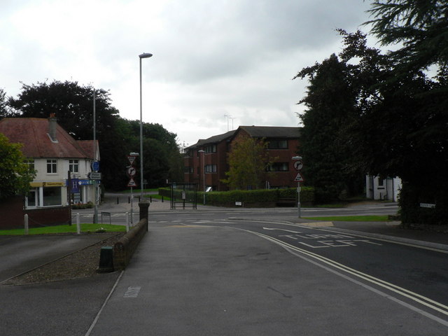
Image: © Chris Downer Taken: 7 Sep 2008
This used to be a busy crossroads, where the four main roads into the town met. Now, though, the main routes north and south have been diverted onto new roads, as illustrated on the map, and the centre of town is quieter, traffic-wise, as a result. North (ahead), we have the now closed Edmondsham Road, leading to the village of that name; east, we have Ringwood Road, the B3081 towards Ringwood; south, Manor Road leads towards West Moors and, eventually, Ferndown and Bournemouth; and west, Station Road takes us past the old railway station to Cranborne, Shaftesbury and Shepton Mallet.
Images are licensed for reuse under creativecommons.org/licenses/by-sa/2.0
Image Location
Latitude
50.881869
Longitude
-1.878981