Verwood: twin towns signpost
Introduction
The photograph on this page of Verwood: twin towns signpost by Chris Downer as part of the Geograph project.
The Geograph project started in 2005 with the aim of publishing, organising and preserving representative images for every square kilometre of Great Britain, Ireland and the Isle of Man.

There are currently over 7.5m images from over 14,400 individuals and you can help contribute to the project by visiting https://www.geograph.org.uk
Verwood: twin towns signpost
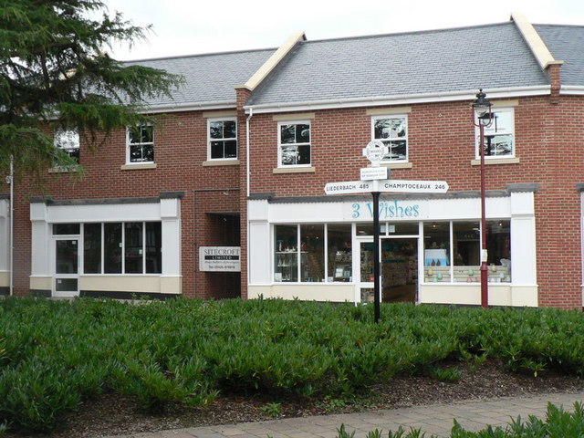
Image: © Chris Downer Taken: 7 Sep 2008
This looks like a useful tool for the misguided motorist, but in fact it wouldn't help him very much. The finial is like an old Dorset fingerpost top, which has location and grid reference on it, but this one says VERWOOD, THREE LEGGED CROSS, TWINNING – and the signs point toward their twin towns of Liederbach, 485 miles to the left, and Champtoceaux, 246 miles to the right. See Image and Image for close-ups of the signpost and Image for the nearest example of the type of sign which it mimics.
Images are licensed for reuse under creativecommons.org/licenses/by-sa/2.0
Image Location
Latitude
50.88106
Longitude
-1.878699