Whitefriars, south end
Introduction
The photograph on this page of Whitefriars, south end by E Gammie as part of the Geograph project.
The Geograph project started in 2005 with the aim of publishing, organising and preserving representative images for every square kilometre of Great Britain, Ireland and the Isle of Man.

There are currently over 7.5m images from over 14,400 individuals and you can help contribute to the project by visiting https://www.geograph.org.uk
Whitefriars, south end
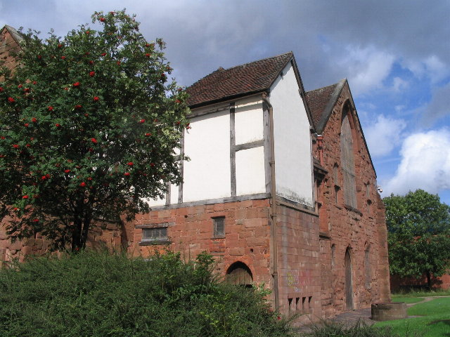
Image: © E Gammie Taken: 3 Sep 2008
A Carmelite friary, founded 1342 with building continuing into the 15th century. The surviving building is the east range of the cloister, containing a cloister walk and part of the chapter house on the ground floor and a dormitory on the first floor. The roof has timbers similar to those in tithe barns which have been dated to trees felled in the last quarter of the 15th century. After the Dissolution, it was acquired by John Hales who converted it to a dwelling known as Hales Place. The surviving building became part of the Workhouse in 1801 and continued as such through to the early 20th century, when it became a shelter for homeless men until the 1970s. The building has grade I listed building status. From the south: http://www.geograph.org.uk/photo/953309 From the north: http://www.geograph.org.uk/photo/953325 From the east: http://www.geograph.org.uk/photo/246381 A gateway to Whitefriars survives at the end of Whitefriars Lane: http://www.geograph.org.uk/photo/951430 , http://www.geograph.org.uk/photo/951451 and http://www.geograph.org.uk/photo/866143
Images are licensed for reuse under creativecommons.org/licenses/by-sa/2.0
Image Location
Latitude
52.404808
Longitude
-1.501509