Reflection under Erewash Canal bridge
Introduction
The photograph on this page of Reflection under Erewash Canal bridge by David Pinney as part of the Geograph project.
The Geograph project started in 2005 with the aim of publishing, organising and preserving representative images for every square kilometre of Great Britain, Ireland and the Isle of Man.

There are currently over 7.5m images from over 14,400 individuals and you can help contribute to the project by visiting https://www.geograph.org.uk
Reflection under Erewash Canal bridge
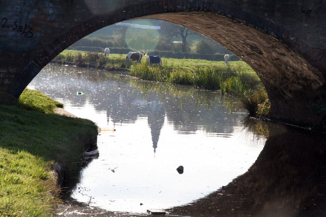
Image: © David Pinney Taken: 21 Oct 2007
The reflection is of Sandiacre Parish Church and Church Farm. The canal was built in 1777-1779 mainly to carry coal cheaply from mines on either side of the Erewash Valley to Leicestershire.
Images are licensed for reuse under creativecommons.org/licenses/by-sa/2.0
Image Location
Latitude
52.931103
Longitude
-1.280218