Road at Rockfield during a wet period
Introduction
The photograph on this page of Road at Rockfield during a wet period by Alan Bowring as part of the Geograph project.
The Geograph project started in 2005 with the aim of publishing, organising and preserving representative images for every square kilometre of Great Britain, Ireland and the Isle of Man.

There are currently over 7.5m images from over 14,400 individuals and you can help contribute to the project by visiting https://www.geograph.org.uk
Road at Rockfield during a wet period
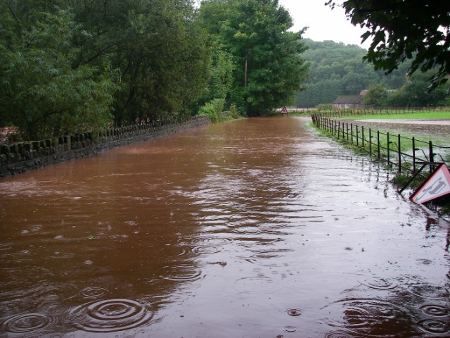
Image: © Alan Bowring Taken: 6 Sep 2008
Passable to 4x4's but not the ordinary motorist. The River Monnow had risen quickly to reach this state after prolonged heavy rain. It usually keeps itself to the left of the wall.
Images are licensed for reuse under creativecommons.org/licenses/by-sa/2.0
Image Location
Latitude
51.830033
Longitude
-2.752654