Westbourne: postbox № BH4 47, Surrey Road
Introduction
The photograph on this page of Westbourne: postbox № BH4 47, Surrey Road by Chris Downer as part of the Geograph project.
The Geograph project started in 2005 with the aim of publishing, organising and preserving representative images for every square kilometre of Great Britain, Ireland and the Isle of Man.

There are currently over 7.5m images from over 14,400 individuals and you can help contribute to the project by visiting https://www.geograph.org.uk
Westbourne: postbox № BH4 47, Surrey Road
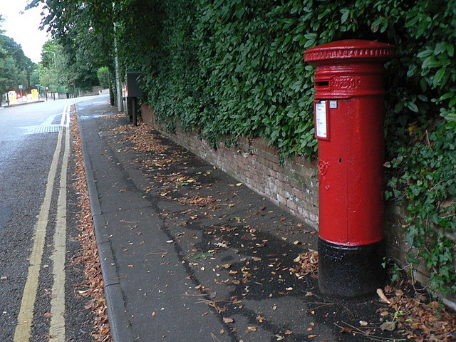
Image: © Chris Downer Taken: 4 Sep 2008
The Westbourne and western Bournemouth area has several Victorian postboxes such as this one in Surrey Road. Just beyond is a very acute crossroads with Prince of Wales Road, which sensibly was made a staggered junction many years ago.
Images are licensed for reuse under creativecommons.org/licenses/by-sa/2.0
Image Location
Latitude
50.725239
Longitude
-1.899927