Temple footbridge
Introduction
The photograph on this page of Temple footbridge by Graham Horn as part of the Geograph project.
The Geograph project started in 2005 with the aim of publishing, organising and preserving representative images for every square kilometre of Great Britain, Ireland and the Isle of Man.

There are currently over 7.5m images from over 14,400 individuals and you can help contribute to the project by visiting https://www.geograph.org.uk
Temple footbridge
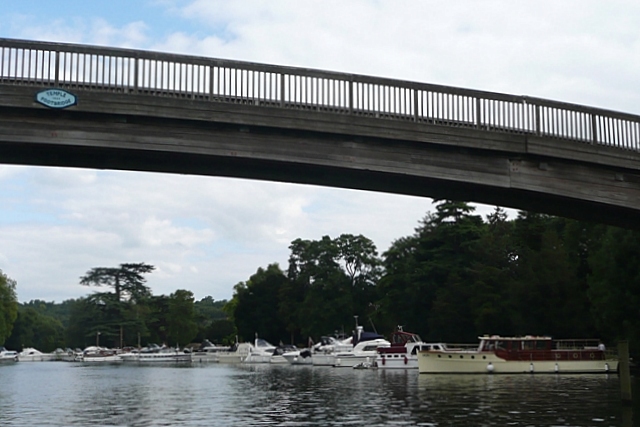
Image: © Graham Horn Taken: 23 Aug 2008
On the short pound between Hurley and Temple Locks, Temple footbridge carries the towpath from the south bank to the north. It was built in 1989 replacing the previous ferry that had closed in 1953! Some maps still show the footpath but not the bridge, implying a walk on the water. The bridge has a height of 21'3" above mean water level at its centre (air draft in nautical parlance).
Images are licensed for reuse under creativecommons.org/licenses/by-sa/2.0
Image Location
Latitude
51.55142
Longitude
-0.797104