Railway bridge at Denny
Introduction
The photograph on this page of Railway bridge at Denny by A-M-Jervis as part of the Geograph project.
The Geograph project started in 2005 with the aim of publishing, organising and preserving representative images for every square kilometre of Great Britain, Ireland and the Isle of Man.

There are currently over 7.5m images from over 14,400 individuals and you can help contribute to the project by visiting https://www.geograph.org.uk
Railway bridge at Denny
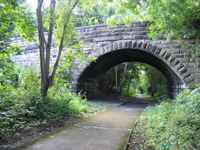
Image: © A-M-Jervis Taken: 26 Jul 2007
Denny was the terminus of passenger trains from Larbert until 1930 but beyond the station two goods-only branches extended to serve paper mills, gravel and sand pits, brick works and collieries. Both extensions have been converted into footpaths since complete closure in the "Beeching era". This is Herbertshire Street bridge No.2 on the branch that ran northwards past Dunipace to Ingliston goods depot. The bridge has been closed to vehicles and now carries only a footpath over "The Old Railway Path".
Images are licensed for reuse under creativecommons.org/licenses/by-sa/2.0
Image Location
Latitude
56.023232
Longitude
-3.902493