After the fire
Introduction
The photograph on this page of After the fire by Richard Croft as part of the Geograph project.
The Geograph project started in 2005 with the aim of publishing, organising and preserving representative images for every square kilometre of Great Britain, Ireland and the Isle of Man.

There are currently over 7.5m images from over 14,400 individuals and you can help contribute to the project by visiting https://www.geograph.org.uk
After the fire
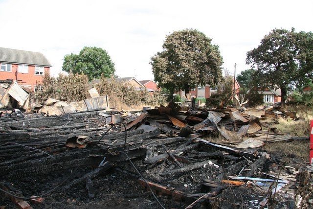
Image: © Richard Croft Taken: 2 Sep 2008
Scorched trees surrounding the site of tin tabernacle St.Matthew's church http://www.geograph.org.uk/photo/183598 mysteriously destroyed by fire on the night of Saturday 30th August 2008 http://news.bbc.co.uk/1/hi/england/lincolnshire/7591704.stm
Images are licensed for reuse under creativecommons.org/licenses/by-sa/2.0
Image Location


Leaflet Map data © OpenStreetMap
Latitude
53.220961
Longitude
-0.553142