Southstoke Hall
Introduction
The photograph on this page of Southstoke Hall by Derek Harper as part of the Geograph project.
The Geograph project started in 2005 with the aim of publishing, organising and preserving representative images for every square kilometre of Great Britain, Ireland and the Isle of Man.

There are currently over 7.5m images from over 14,400 individuals and you can help contribute to the project by visiting https://www.geograph.org.uk
Southstoke Hall
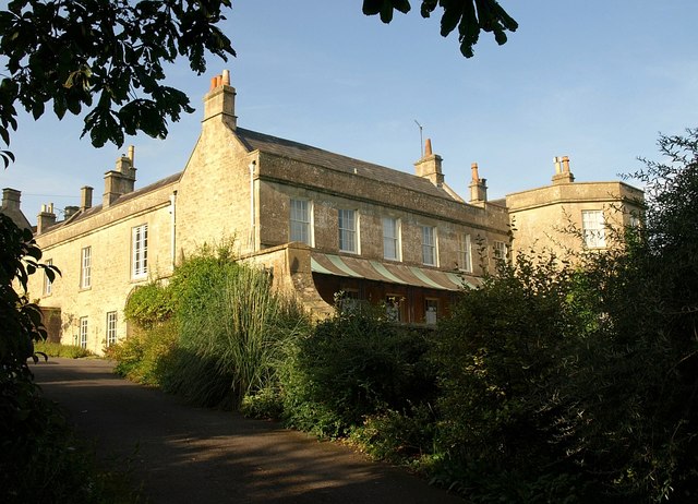
Image: © Derek Harper Taken: 25 Aug 2008
"Southstoke Hall ... is a former Vicarage and dates from the 13th Century". http://www.calverleywing.co.uk/findus.htm Nothing visible here looks older than the C18, but it is a beautiful house, past which a footpath runs up to Packhorse Lane.
Images are licensed for reuse under creativecommons.org/licenses/by-sa/2.0
Image Location
Latitude
51.349855
Longitude
-2.362804