View from former Unitarian Church, Todmorden
Introduction
The photograph on this page of View from former Unitarian Church, Todmorden by Humphrey Bolton as part of the Geograph project.
The Geograph project started in 2005 with the aim of publishing, organising and preserving representative images for every square kilometre of Great Britain, Ireland and the Isle of Man.

There are currently over 7.5m images from over 14,400 individuals and you can help contribute to the project by visiting https://www.geograph.org.uk
View from former Unitarian Church, Todmorden
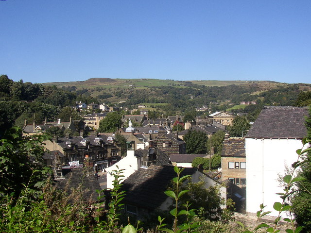
Image: © Humphrey Bolton Taken: Unknown
The church's elevated position gives a good view over the town centre. In the middle distance is the main road, with a row of shops and the Golden Lion Inn. In the distance the Parish Church and the Town Hall can be seen.
Images are licensed for reuse under creativecommons.org/licenses/by-sa/2.0
Image Location


Leaflet Map data © OpenStreetMap
Latitude
53.711479
Longitude
-2.099957