Woolfardisworthy: Woolsery Mill Farm
Introduction
The photograph on this page of Woolfardisworthy: Woolsery Mill Farm by Martin Bodman as part of the Geograph project.
The Geograph project started in 2005 with the aim of publishing, organising and preserving representative images for every square kilometre of Great Britain, Ireland and the Isle of Man.

There are currently over 7.5m images from over 14,400 individuals and you can help contribute to the project by visiting https://www.geograph.org.uk
Woolfardisworthy: Woolsery Mill Farm
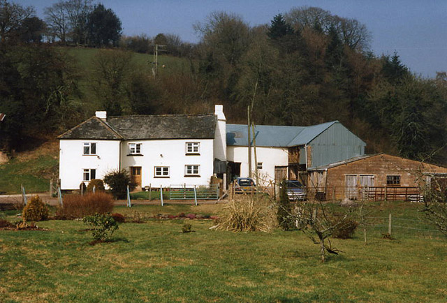
Image: © Martin Bodman Taken: 10 Mar 1996
Now a private residence and farm. Seen from the lane from Woolfardisworthy to Poughill. And according to the Ordnance Survey Pathfinder map 1295 a public footpath runs immediately behind the buildings to Puddington Bottom. In 1873 there were grist and flour mills to let here with two waterwheels driving three pairs of millstones and a circular saw. [Source: The Western Times 14 March 1873 p 1 col 1]
Images are licensed for reuse under creativecommons.org/licenses/by-sa/2.0
Image Location


Leaflet Map data © OpenStreetMap
Latitude
50.865072
Longitude
-3.661097