Packhorse way at Mankinholes, Langfield
Introduction
The photograph on this page of Packhorse way at Mankinholes, Langfield by Humphrey Bolton as part of the Geograph project.
The Geograph project started in 2005 with the aim of publishing, organising and preserving representative images for every square kilometre of Great Britain, Ireland and the Isle of Man.

There are currently over 7.5m images from over 14,400 individuals and you can help contribute to the project by visiting https://www.geograph.org.uk
Packhorse way at Mankinholes, Langfield
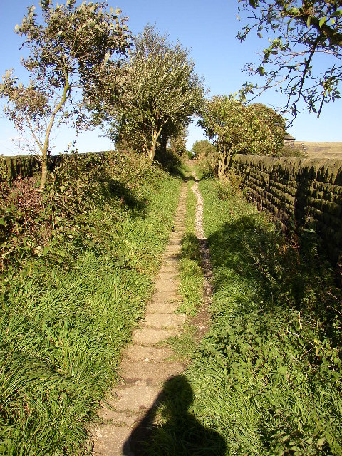
Image: © Humphrey Bolton Taken: 15 Sep 2004
There are many of these paved tracks in Calderdale, dating from the time when there were few roads fit for wagons and the woollen industry was very important.(I have since discovered that I can get rid of my shadow by standing further back and zooming the lens out!)
Images are licensed for reuse under creativecommons.org/licenses/by-sa/2.0
Image Location


Leaflet Map data © OpenStreetMap
Latitude
53.708806
Longitude
-2.066621