Rebuilding Walton
Introduction
The photograph on this page of Rebuilding Walton by Oliver White as part of the Geograph project.
The Geograph project started in 2005 with the aim of publishing, organising and preserving representative images for every square kilometre of Great Britain, Ireland and the Isle of Man.

There are currently over 7.5m images from over 14,400 individuals and you can help contribute to the project by visiting https://www.geograph.org.uk
Rebuilding Walton
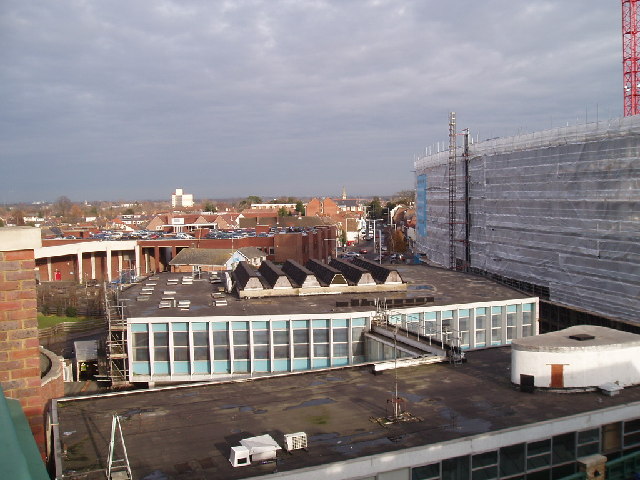
Image: © Oliver White Taken: 22 Dec 2005
New Walton town centre (on right, under the cladding). Two buildings in foreground connected by bridge are Beales. In distance, view down the A3059 towards Molesey. View taken from new Sainsbury's roof.
Images are licensed for reuse under creativecommons.org/licenses/by-sa/2.0
Image Location


Leaflet Map data © OpenStreetMap
Latitude
51.385976
Longitude
-0.419171