Under the arches of the Engine Lonning Bridge
Introduction
The photograph on this page of Under the arches of the Engine Lonning Bridge by Oliver Dixon as part of the Geograph project.
The Geograph project started in 2005 with the aim of publishing, organising and preserving representative images for every square kilometre of Great Britain, Ireland and the Isle of Man.

There are currently over 7.5m images from over 14,400 individuals and you can help contribute to the project by visiting https://www.geograph.org.uk
Under the arches of the Engine Lonning Bridge
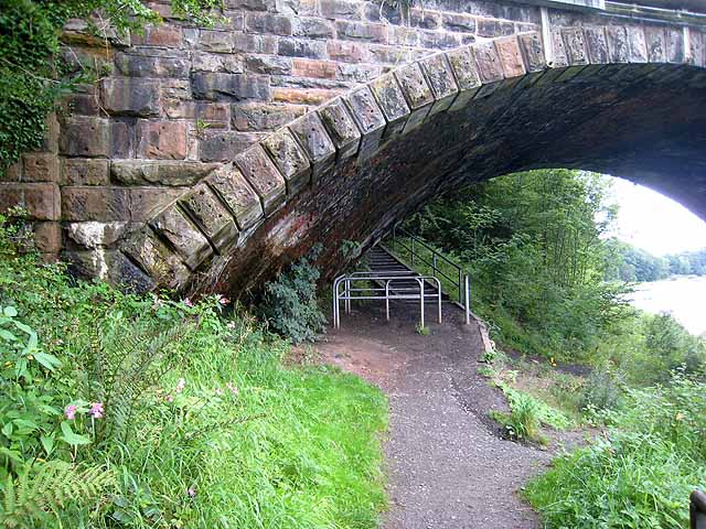
Image: © Oliver Dixon Taken: 28 Aug 2008
The path under the arch of the old railway bridge which used to carry the "Waverley" railway line (Carlisle to Edinburgh) carries both Hadrians Wall National Trail http://www.nationaltrail.co.uk/hadrianswall/ and Hadrian's Cycleway http://www.cycle-routes.org/hadrianscycleway/ . For cyclists, it is a fairly unsatisfactory route (described as "interim") as it requires cyclists to negotiate a flight of steps with a "wheeling ramp" immediately beyond the bridge - not easy with a fully-laden bike.
Images are licensed for reuse under creativecommons.org/licenses/by-sa/2.0
Image Location
Latitude
54.898513
Longitude
-2.962066