A clear view of the railway
Introduction
The photograph on this page of A clear view of the railway by Stephen Craven as part of the Geograph project.
The Geograph project started in 2005 with the aim of publishing, organising and preserving representative images for every square kilometre of Great Britain, Ireland and the Isle of Man.

There are currently over 7.5m images from over 14,400 individuals and you can help contribute to the project by visiting https://www.geograph.org.uk
A clear view of the railway
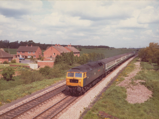
Image: © Stephen Craven Taken: 15 May 1981
Another view north from the railway bridge at Radley, 25 years earlier than Image Note how much less vegetation there was either side of the line then. The train is headed by a class 47 diesel so would have been a cross-country service from the North of England to one of the south coast towns, probably Poole.
Images are licensed for reuse under creativecommons.org/licenses/by-sa/2.0
Image Location


Leaflet Map data © OpenStreetMap
Latitude
51.688198
Longitude
-1.240058