Castell Cawr
Introduction
The photograph on this page of Castell Cawr by Jonathan Wilkins as part of the Geograph project.
The Geograph project started in 2005 with the aim of publishing, organising and preserving representative images for every square kilometre of Great Britain, Ireland and the Isle of Man.

There are currently over 7.5m images from over 14,400 individuals and you can help contribute to the project by visiting https://www.geograph.org.uk
Castell Cawr
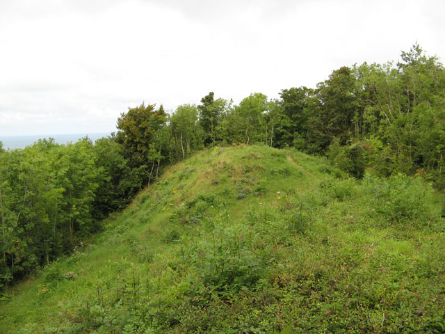
Image: © Jonathan Wilkins Taken: 22 Aug 2008
The forest has been cut back here to reveal the sizeable main rampart of the fine hill-fort that occupies this excellent defensive position on top of the cliff above Abergele. The main rampart secures the western side of the hilltop and there are many other ditches partly hidden in the trees.
Images are licensed for reuse under creativecommons.org/licenses/by-sa/2.0
Image Location
Latitude
53.276386
Longitude
-3.597428