Tunstall House
Introduction
The photograph on this page of Tunstall House by Penny Mayes as part of the Geograph project.
The Geograph project started in 2005 with the aim of publishing, organising and preserving representative images for every square kilometre of Great Britain, Ireland and the Isle of Man.

There are currently over 7.5m images from over 14,400 individuals and you can help contribute to the project by visiting https://www.geograph.org.uk
Tunstall House
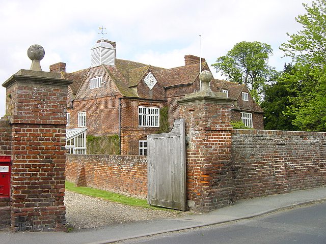
Image: © Penny Mayes Taken: 12 May 2005
This small community to the south of Sittingbourne has a number of rather grand houses, an Anglican church and school but no shop or pub. For listing details of Tunstall House see https://historicengland.org.uk/listing/the-list/list-entry/1069357
Images are licensed for reuse under creativecommons.org/licenses/by-sa/2.0
Image Location


Leaflet Map data © OpenStreetMap
Latitude
51.324012
Longitude
0.717768