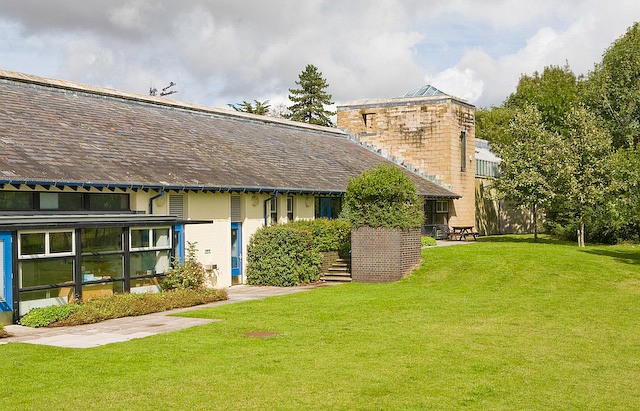
St Margaret's Church, Downs Road, South Wonston
Introduction
The photograph on this page of St Margaret's Church, Downs Road, South Wonston by Peter Facey as part of the Geograph project.
The Geograph project started in 2005 with the aim of publishing, organising and preserving representative images for every square kilometre of Great Britain, Ireland and the Isle of Man.
There are currently over 7.5m images from over 14,400 individuals and you can help contribute to the project by visiting https://www.geograph.org.uk

Image: © Peter Facey Taken: 24 Aug 2008
South Wonston Primary School (http://southwonston.hants.sch.uk/ ) and St Margaret's Church (http://www.southwonston-church.co.uk/index.html ) share the site and the church (right), which was built in 1996, is joined to the school buildings (left). The church occupies a narrow site within the row of residential houses along Downs Road. The church was partly sunken to meet objections about its height from neighbours. The tower-like structure sadly lacks a spire or other feature to top it off. The rectangular hole in the masonry at the top left of the tower, which I first thought might contain a bell, in fact contains a TV aerial. This southeastern side of the church is only visible from the grounds of the school which are not open to the public. Access for this photograph by kind permission of St Margaret's.

