Pill Box on Stainer's Lane, South Wonston
Introduction
The photograph on this page of Pill Box on Stainer's Lane, South Wonston by Peter Facey as part of the Geograph project.
The Geograph project started in 2005 with the aim of publishing, organising and preserving representative images for every square kilometre of Great Britain, Ireland and the Isle of Man.

There are currently over 7.5m images from over 14,400 individuals and you can help contribute to the project by visiting https://www.geograph.org.uk
Pill Box on Stainer's Lane, South Wonston
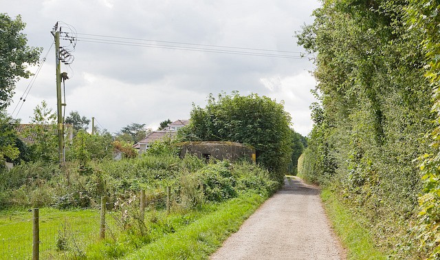
Image: © Peter Facey Taken: 23 Aug 2008
Stainer's Lane is a bridleway. It is here crossing a line of houses along Stavedown Road. The pill box is a type 22, is one of a line defending Worthy Down Camp and dates from 1940.
Images are licensed for reuse under creativecommons.org/licenses/by-sa/2.0
Image Location


Leaflet Map data © OpenStreetMap
Latitude
51.121592
Longitude
-1.338263