St Teath: cutting out the slate
Introduction
The photograph on this page of St Teath: cutting out the slate by Martin Bodman as part of the Geograph project.
The Geograph project started in 2005 with the aim of publishing, organising and preserving representative images for every square kilometre of Great Britain, Ireland and the Isle of Man.

There are currently over 7.5m images from over 14,400 individuals and you can help contribute to the project by visiting https://www.geograph.org.uk
St Teath: cutting out the slate
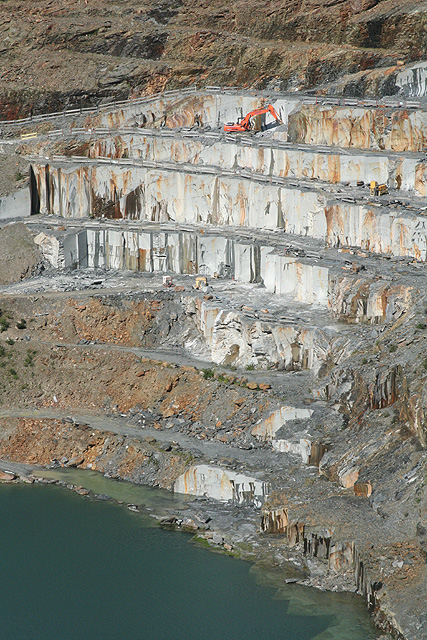
Image: © Martin Bodman Taken: 22 Aug 2008
A telephoto view of twenty-first century quarrying at the Delabole slate quarry. Only five skilled men work in the quarry pit in the twenty-first century; hundreds worked here in the mid-nineteenth century
Images are licensed for reuse under creativecommons.org/licenses/by-sa/2.0
Image Location


Leaflet Map data © OpenStreetMap
Latitude
50.62478
Longitude
-4.721529