Poplar: Docklands Light Railway
Introduction
The photograph on this page of Poplar: Docklands Light Railway by Nigel Cox as part of the Geograph project.
The Geograph project started in 2005 with the aim of publishing, organising and preserving representative images for every square kilometre of Great Britain, Ireland and the Isle of Man.

There are currently over 7.5m images from over 14,400 individuals and you can help contribute to the project by visiting https://www.geograph.org.uk
Poplar: Docklands Light Railway
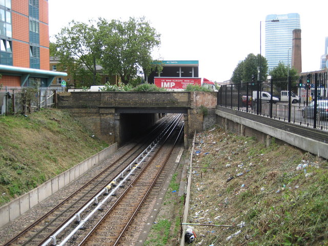
Image: © Nigel Cox Taken: 19 Aug 2008
Viewed from the Susannah Street bridge and looking towards the East India Dock Road bridge, the Docklands Light Railway (DLR) here uses the route of the former North London Railway (NLR) between Poplar and Bow. The entrance façade to All Saints DLR station can be seen on the far side of the bridge. All Saints is named after the nearby church and was previously the site of Poplar station on the NLR. Image is visible on the right and the base of Image is visible on the left.
Images are licensed for reuse under creativecommons.org/licenses/by-sa/2.0
Image Location
Latitude
51.511269
Longitude
-0.013196