Pyecombe Manor
Introduction
The photograph on this page of Pyecombe Manor by Simon Carey as part of the Geograph project.
The Geograph project started in 2005 with the aim of publishing, organising and preserving representative images for every square kilometre of Great Britain, Ireland and the Isle of Man.

There are currently over 7.5m images from over 14,400 individuals and you can help contribute to the project by visiting https://www.geograph.org.uk
Pyecombe Manor
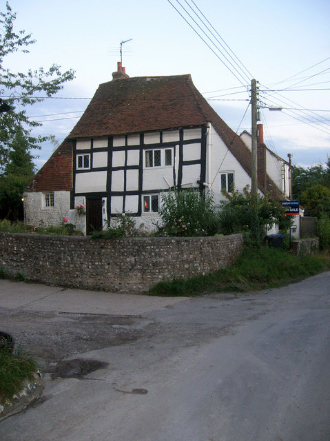
Image: © Simon Carey Taken: 22 Aug 2008
A remnant of a much bigger 16th century house, possibly a manor house though records indicate the manor resided in Pangdean rather than Pyecombe, so this may have been a large house built after the village moved its centre of population away from Pyecombe church to this part known as Pyecombe Street.
Images are licensed for reuse under creativecommons.org/licenses/by-sa/2.0
Image Location
Latitude
50.901747
Longitude
-0.174652