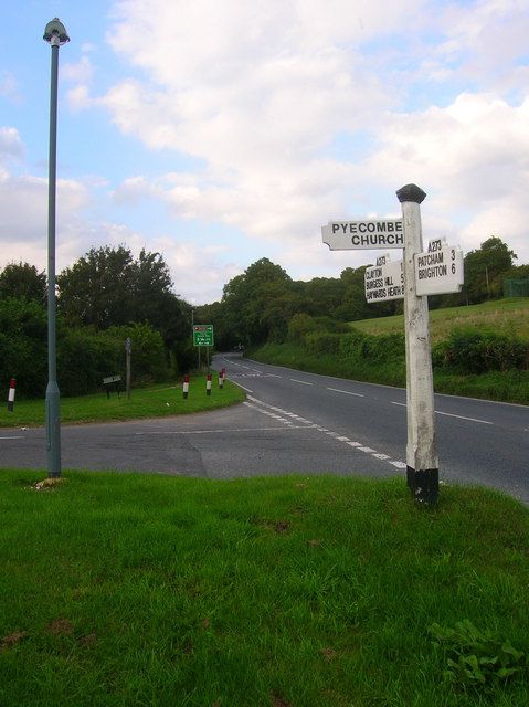
Clayton Hill
Introduction
The photograph on this page of Clayton Hill by Simon Carey as part of the Geograph project.
The Geograph project started in 2005 with the aim of publishing, organising and preserving representative images for every square kilometre of Great Britain, Ireland and the Isle of Man.
There are currently over 7.5m images from over 14,400 individuals and you can help contribute to the project by visiting https://www.geograph.org.uk

Image: © Simon Carey Taken: 22 Aug 2008
Looking up the A273 from the junction with School Lane. An early example of a bypass as it was constructed in the mid 19th century to avoid the steep climb into Pyecombe. This stretch of road can be quite dangerous as the southbound traffic has a tendency to speed down the hill whilst the northbound zooms off the A23 often ignoring the 50mph speed limit and the signs concerning the South Downs Way whose users, on foot and horseback, cross the road halfway up. In fact School Lane takes the South Downs Way into Pyecombe having followed the road down the hill and meeting the lane to the left of the green warning sign.

