Haynes Road, Westbury
Introduction
The photograph on this page of Haynes Road, Westbury by Phil Williams as part of the Geograph project.
The Geograph project started in 2005 with the aim of publishing, organising and preserving representative images for every square kilometre of Great Britain, Ireland and the Isle of Man.

There are currently over 7.5m images from over 14,400 individuals and you can help contribute to the project by visiting https://www.geograph.org.uk
Haynes Road, Westbury
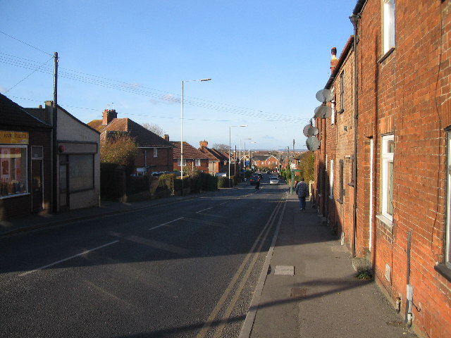
Image: © Phil Williams Taken: 17 Dec 2005
Looking northwest down the A350, Haynes Road from Warminster Road. The A350 is major route for ferry traffic from Poole to the M4 motorway. The brick building at the end of the road in the distance is Eastleigh surgery. Westbury High street is just off to the right where the two vehicles are passing.
Images are licensed for reuse under creativecommons.org/licenses/by-sa/2.0
Image Location


Leaflet Map data © OpenStreetMap
Latitude
51.258915
Longitude
-2.184816