Kinsham from the air
Introduction
The photograph on this page of Kinsham from the air by Philip Halling as part of the Geograph project.
The Geograph project started in 2005 with the aim of publishing, organising and preserving representative images for every square kilometre of Great Britain, Ireland and the Isle of Man.

There are currently over 7.5m images from over 14,400 individuals and you can help contribute to the project by visiting https://www.geograph.org.uk
Kinsham from the air
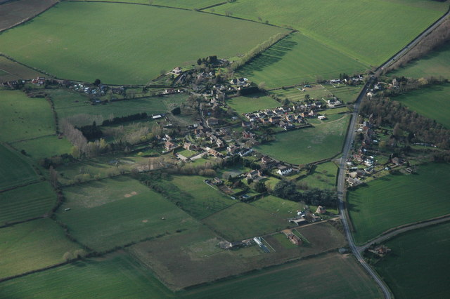
Image: © Philip Halling Taken: 12 Apr 2008
Kinsham is a small village to the south of the larger village of Bredon. The B4079 can be seen running from top to bottom
Images are licensed for reuse under creativecommons.org/licenses/by-sa/2.0
Image Location


Leaflet Map data © OpenStreetMap
Latitude
52.018153
Longitude
-2.096712