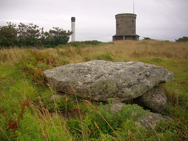
Buzza Hill, St. Mary's
Introduction
The photograph on this page of Buzza Hill, St. Mary's by Bob Embleton as part of the Geograph project.
The Geograph project started in 2005 with the aim of publishing, organising and preserving representative images for every square kilometre of Great Britain, Ireland and the Isle of Man.
There are currently over 7.5m images from over 14,400 individuals and you can help contribute to the project by visiting https://www.geograph.org.uk

Image: © Bob Embleton Taken: 6 Aug 2008
Three ages - three landmarks. An ancient chambered cairn, known as an entrance grave, whose mound would have been visible from all land and sea around. A 19th century windmill converted to a memorial to King Edward has been a landmark for over 160 years. The island has its own power generator and its chimney is the landmark of the modern era.

