Elland Wesleyan Chapel
Introduction
The photograph on this page of Elland Wesleyan Chapel by Tim Marchant as part of the Geograph project.
The Geograph project started in 2005 with the aim of publishing, organising and preserving representative images for every square kilometre of Great Britain, Ireland and the Isle of Man.

There are currently over 7.5m images from over 14,400 individuals and you can help contribute to the project by visiting https://www.geograph.org.uk
Elland Wesleyan Chapel
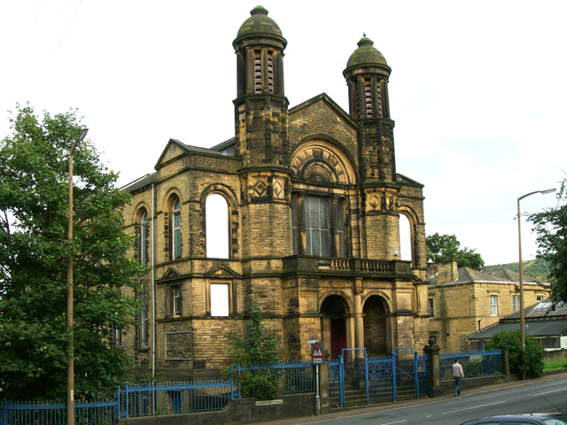
Image: © Tim Marchant Taken: 20 Aug 2008
Marked on the official Calderdale council maps as a works building, this former chapel appears disused.
Images are licensed for reuse under creativecommons.org/licenses/by-sa/2.0
Image Location


Leaflet Map data © OpenStreetMap
Latitude
53.686422
Longitude
-1.835827