Moat, Doddershall House
Introduction
The photograph on this page of Moat, Doddershall House by Andy Gryce as part of the Geograph project.
The Geograph project started in 2005 with the aim of publishing, organising and preserving representative images for every square kilometre of Great Britain, Ireland and the Isle of Man.

There are currently over 7.5m images from over 14,400 individuals and you can help contribute to the project by visiting https://www.geograph.org.uk
Moat, Doddershall House
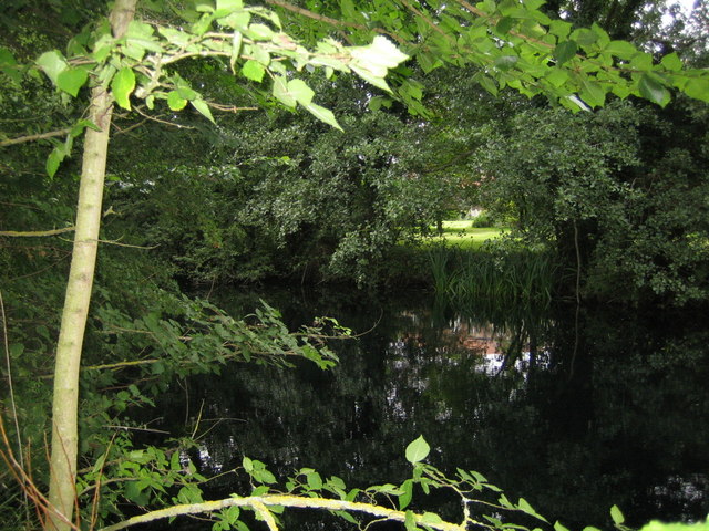
Image: © Andy Gryce Taken: 17 Aug 2008
This moat lies on the south-west side of Doddershall House, see Image The house was originally surrounded by a quadrangular moat, of which only this section, about 125m long, and some other traces, remain. The house can just be seen through the trees, and more so in the reflection in the water. The building of moats in Britain seems to have begun around the middle of the twelfth century, but reached its peak between 1200 and 1325. Although moats did have some economic and defensive benefits, they seem more to have been status symbols and their proliferation was largely due to fashion, and this might well apply to this moat. There are quite a number of references to moats on OS maps of this area, though this part of Buckinghamshire actually has fewer than say Bedfordshire and south of Aylesbury nearer the Chilterns.
Images are licensed for reuse under creativecommons.org/licenses/by-sa/2.0
Image Location


Leaflet Map data © OpenStreetMap
Latitude
51.874289
Longitude
-0.955124