High Wycombe: Former railway line to Bourne End
Introduction
The photograph on this page of High Wycombe: Former railway line to Bourne End by Nigel Cox as part of the Geograph project.
The Geograph project started in 2005 with the aim of publishing, organising and preserving representative images for every square kilometre of Great Britain, Ireland and the Isle of Man.

There are currently over 7.5m images from over 14,400 individuals and you can help contribute to the project by visiting https://www.geograph.org.uk
High Wycombe: Former railway line to Bourne End
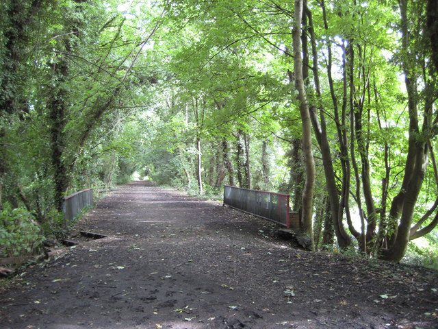
Image: © Nigel Cox Taken: 13 Aug 2008
This is the trackbed of what was once Brunel's broad gauge Wycombe Railway. Opened in 1854 it was the main line between High Wycombe and London via Maidenhead until the construction of the far more direct Great Western and Great Central Joint Railway to and from London Marylebone in 1899. The former Wycombe Railway north of Bourne End was a fairly inevitable victim of the Beeching axe and closed in 1970. The trackbed crosses the valley of the River Wye on an embankment here, and the railings indicate the location of Image
Images are licensed for reuse under creativecommons.org/licenses/by-sa/2.0
Image Location


Leaflet Map data © OpenStreetMap
Latitude
51.621647
Longitude
-0.728944