High Wycombe: Easton Terrace alleyway
Introduction
The photograph on this page of High Wycombe: Easton Terrace alleyway by Nigel Cox as part of the Geograph project.
The Geograph project started in 2005 with the aim of publishing, organising and preserving representative images for every square kilometre of Great Britain, Ireland and the Isle of Man.

There are currently over 7.5m images from over 14,400 individuals and you can help contribute to the project by visiting https://www.geograph.org.uk
High Wycombe: Easton Terrace alleyway
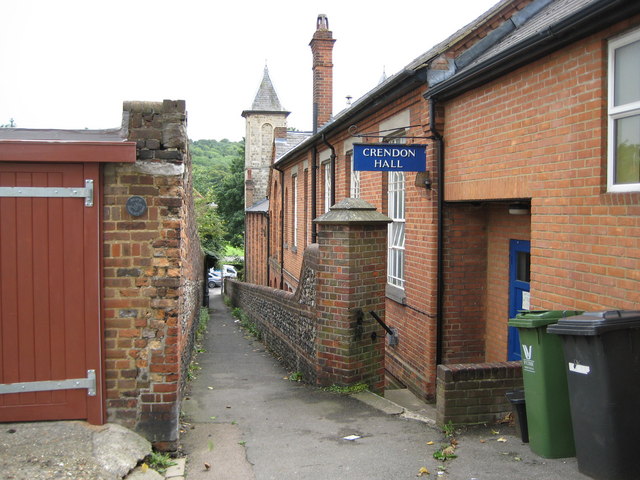
Image: © Nigel Cox Taken: 13 Aug 2008
This alleyway runs down from Easton Terrace to the London Road along the east side of Image, one of whose towers can be seen at the end. On the right is Crendon Hall, added in 1923 to the rear of the church as a meeting room, and named Crendon after an adjacent street. The small grey plaque on the brick pier on the left records the fact that this point used to have an old boundary stone.
Images are licensed for reuse under creativecommons.org/licenses/by-sa/2.0
Image Location


Leaflet Map data © OpenStreetMap
Latitude
51.627373
Longitude
-0.742943