The Stotts Arms updated, Wakefield Road, Brighouse
Introduction
The photograph on this page of The Stotts Arms updated, Wakefield Road, Brighouse by Humphrey Bolton as part of the Geograph project.
The Geograph project started in 2005 with the aim of publishing, organising and preserving representative images for every square kilometre of Great Britain, Ireland and the Isle of Man.

There are currently over 7.5m images from over 14,400 individuals and you can help contribute to the project by visiting https://www.geograph.org.uk
The Stotts Arms updated, Wakefield Road, Brighouse
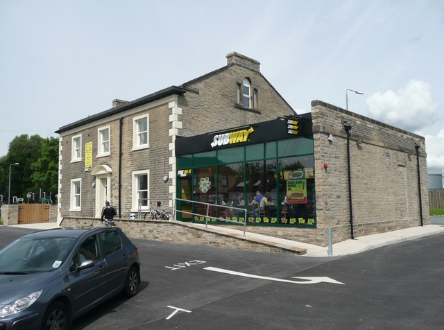
Image: © Humphrey Bolton Taken: 15 Aug 2008
See Image After a lengthy refurbishment the single storey extension has become a Subway café, and the main building still awaits a tenant.
Images are licensed for reuse under creativecommons.org/licenses/by-sa/2.0
Image Location
Latitude
53.702323
Longitude
-1.775782