Loch Br?igh na h-Aoidhe
Introduction
The photograph on this page of Loch Br?igh na h-Aoidhe by Angus Peck as part of the Geograph project.
The Geograph project started in 2005 with the aim of publishing, organising and preserving representative images for every square kilometre of Great Britain, Ireland and the Isle of Man.

There are currently over 7.5m images from over 14,400 individuals and you can help contribute to the project by visiting https://www.geograph.org.uk
Loch Br?igh na h-Aoidhe
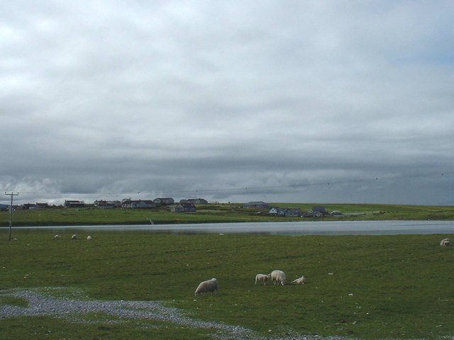
Image: © Angus Peck Taken: 28 Jun 2005
This picture of Loch Bràigh na h-Aoidhe was taken from the A866 which connects the Eye Peninsula to Stornoway and the rest of the island, just behind the loch is the village and Stornoway Airport and in front the sheep are grazing. The light coloured area at the bottom of the picture is actually pebbles and shale that was washed over the Bràigh wall during a Hurricane that hit us in January of that year, the Eye Peninsula was totally cut of for 20 hours till the wind and sea subsided enough for a team of diggers and lorries could move in to clear thousands of tons of rubble of the road
Images are licensed for reuse under creativecommons.org/licenses/by-sa/2.0
Image Location
Latitude
58.207648
Longitude
-6.305128