Churchtown, Mainstone
Introduction
The photograph on this page of Churchtown, Mainstone by Angela Jones as part of the Geograph project.
The Geograph project started in 2005 with the aim of publishing, organising and preserving representative images for every square kilometre of Great Britain, Ireland and the Isle of Man.

There are currently over 7.5m images from over 14,400 individuals and you can help contribute to the project by visiting https://www.geograph.org.uk
Churchtown, Mainstone
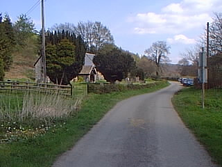
Image: © Angela Jones Taken: 12 Jun 2001
Looking east along the road past Mainstone Church at Churchtown (the picture is taken from immediately west of the point where the route of Offa's Dyke crosses the road -- compare http://www.geograph.org.uk/photo/390053 showing the other side of the roadsigns)
Images are licensed for reuse under creativecommons.org/licenses/by-sa/2.0
Image Location


Leaflet Map data © OpenStreetMap
Latitude
52.478643
Longitude
-3.085106