St. Mary's church, Seven Sisters
Introduction
The photograph on this page of St. Mary's church, Seven Sisters by Jonathan Billinger as part of the Geograph project.
The Geograph project started in 2005 with the aim of publishing, organising and preserving representative images for every square kilometre of Great Britain, Ireland and the Isle of Man.

There are currently over 7.5m images from over 14,400 individuals and you can help contribute to the project by visiting https://www.geograph.org.uk
St. Mary's church, Seven Sisters
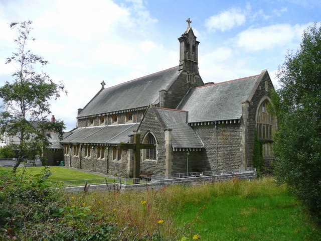
Image: © Jonathan Billinger Taken: 8 Aug 2008
The village of Seven Sisters had always been recognised historically for its coal mining pit that was located in the middle of what was once one of the richest sources of coal in Britain, if not the world in the heart of the South Wales Coalfield. The sinking of the pit began when Miss Isobella Bevan, one of seven daughters of local coal-owner Evan Evans-Bevan cut the first sod of the colliery on Monday, March 11 1872, leading to its completion in 1875. Initially, Evans-Bevan had wanted to name the pit after his first daughter, Isobella, but reconsidered and named it after all his seven daughters, hence the name of Seven Sisters Colliery. In turn as the community grew around the colliery, it also adopted its name, Seven Sisters village. At its peak in 1945 the colliery employed over 759 men from the surrounding area. However, during the 1950s geological problems and changing economic conditions took their toll on the colliery and in 1963 the pit closed. The men who had been employed at the Seven Sisters were transferred to the nearby Blaenant Colliery, which closed in 1990. After the closure of the Seven Sisters Colliery in 1963 the site was demolished and filled in. Today the site is home to playing fields but the history of what existed in the village still remains, with the pit head winding gear sunk in the ground next to the site of the old colliery. Source; Wikipedia This church seems to date from the same era as the heyday of mining.
Images are licensed for reuse under creativecommons.org/licenses/by-sa/2.0
Image Location


Leaflet Map data © OpenStreetMap
Latitude
51.767249
Longitude
-3.71445