
Cannons and the Beheading Stone on Mote Hill
Introduction
The photograph on this page of Cannons and the Beheading Stone on Mote Hill by Lairich Rig as part of the Geograph project.
The Geograph project started in 2005 with the aim of publishing, organising and preserving representative images for every square kilometre of Great Britain, Ireland and the Isle of Man.

There are currently over 7.5m images from over 14,400 individuals and you can help contribute to the project by visiting https://www.geograph.org.uk
Cannons and the Beheading Stone on Mote Hill
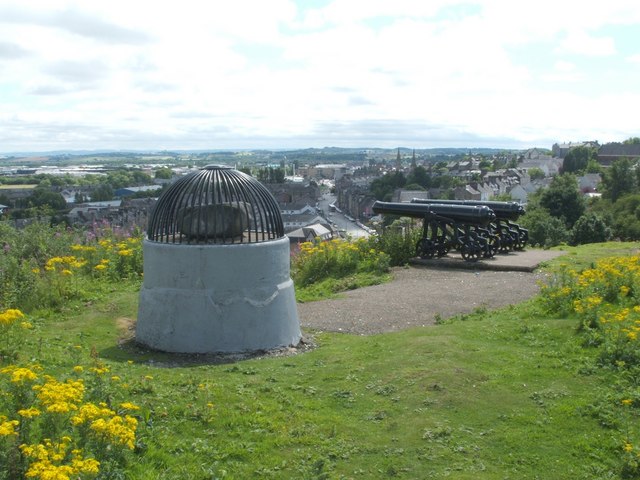
Image: © Lairich Rig Taken: 22 Jul 2008
For more on the Beheading Stone, see Image and Image (the latter has a very useful link to Canmore's entry on Mote Hill). The structure containing the stone has a plaque on the far side. For a view from that side, for the text of the plaque, and for comments by the eighteenth-century historian William Nimmo that explain the name of the stone, see Image, which was taken on the same occasion as the present photograph. Gowan Hill is nearby. The high ground here was formerly known as the Gowan Hills, embracing what is now Mote Hill, Gowan Hill, and the part that was subsequently reshaped to form Ballengeich Cemetery. In past centuries, Gowan Hill was, according to a nearby information panel, the scene of an unusual form of sledging. King James V, born in 1512, and king from 1513-42 (regents ruled Scotland during his childhood) is thought to have played Hurley Hawkie here as a boy (or "Hurly Haaky" – see the Canmore link mentioned above for more on this; see also the headword "Hurlie-Hacket" — https://dsl.ac.uk/entry/snd/hurliehacket — in the Dictionary of the Scots Language). This pastime, which was played here for centuries, involved sliding down the steep hill (here, supposedly, this was done while sitting on a cow's skull, using its horns as handlebars; in an agricultural market town like Stirling, skulls were readily available). In any case, it is thought that the name of the pastime was transferred to the hill.
Images are licensed for reuse under creativecommons.org/licenses/by-sa/2.0
Image Location

Latitude
56.127654
Longitude
-3.942884