Savile Road, Elland
Introduction
The photograph on this page of Savile Road, Elland by Humphrey Bolton as part of the Geograph project.
The Geograph project started in 2005 with the aim of publishing, organising and preserving representative images for every square kilometre of Great Britain, Ireland and the Isle of Man.

There are currently over 7.5m images from over 14,400 individuals and you can help contribute to the project by visiting https://www.geograph.org.uk
Savile Road, Elland
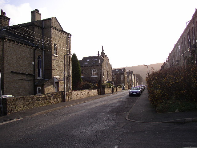
Image: © Humphrey Bolton Taken: 15 Dec 2005
Savile Road runs from Victoria Road at SE106127 SSE to South Lane. No doubt Lord Savile made a fortune selling the land! It forms the top side of the Elland grid of streets, so that on the left there are the gable-ends of terraces running down towards the town centre. All Saints' Church is further along on the left.
Images are licensed for reuse under creativecommons.org/licenses/by-sa/2.0
Image Location
Latitude
53.680854
Longitude
-1.839482