Rugby Road, Brandon
Introduction
The photograph on this page of Rugby Road, Brandon by Stephen McKay as part of the Geograph project.
The Geograph project started in 2005 with the aim of publishing, organising and preserving representative images for every square kilometre of Great Britain, Ireland and the Isle of Man.

There are currently over 7.5m images from over 14,400 individuals and you can help contribute to the project by visiting https://www.geograph.org.uk
Rugby Road, Brandon
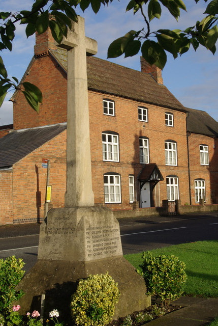
Image: © Stephen McKay Taken: 10 Aug 2008
The war memorial is in the foreground; on the opposite side of the A428, the large house is called Woodcroft.
Images are licensed for reuse under creativecommons.org/licenses/by-sa/2.0
Image Location


Leaflet Map data © OpenStreetMap
Latitude
52.38519
Longitude
-1.400497