Shoebury: High Street level crossing
Introduction
The photograph on this page of Shoebury: High Street level crossing by Nigel Cox as part of the Geograph project.
The Geograph project started in 2005 with the aim of publishing, organising and preserving representative images for every square kilometre of Great Britain, Ireland and the Isle of Man.

There are currently over 7.5m images from over 14,400 individuals and you can help contribute to the project by visiting https://www.geograph.org.uk
Shoebury: High Street level crossing
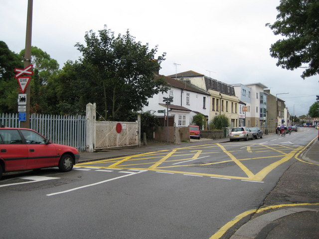
Image: © Nigel Cox Taken: 3 Aug 2008
This level crossing allows trains access to and from MOD Pig's Bay. The railway line starts in the sidings to the west of Shoeburyness station, swings around the south side of the station, before crossing Shoebury High Street here. One of the uses of the MOD base is for the storage of withdrawn rolling stock prior to scrapping. The London Tilbury and Southend Railway reached Shoeburyness in 1884 and the level crossing is already shown in the Ordnance Survey map edition of 1898. From a Geograph aspect the railway track lines up almost exactly with the 185000 Northing grid line. The detail beyond the level crossing is in Image
Images are licensed for reuse under creativecommons.org/licenses/by-sa/2.0
Image Location
Latitude
51.530557
Longitude
0.796098