Egham Hythe: Hythe Primary School
Introduction
The photograph on this page of Egham Hythe: Hythe Primary School by Nigel Cox as part of the Geograph project.
The Geograph project started in 2005 with the aim of publishing, organising and preserving representative images for every square kilometre of Great Britain, Ireland and the Isle of Man.

There are currently over 7.5m images from over 14,400 individuals and you can help contribute to the project by visiting https://www.geograph.org.uk
Egham Hythe: Hythe Primary School
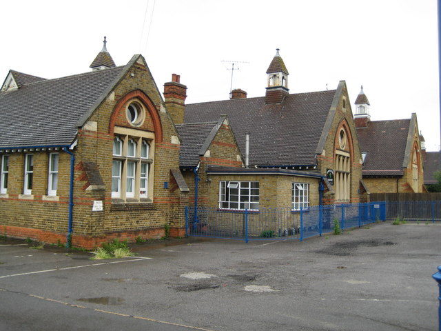
Image: © Nigel Cox Taken: 5 Aug 2008
Old Ordnance Survey maps show these buildings in the Edition of 1899, but not in the Edition of 1882. The building at the end beyond the close board fence appears to have been sold off for residential use. The School's website is here http://www.hythe.surrey.sch.uk/index.htm
Images are licensed for reuse under creativecommons.org/licenses/by-sa/2.0
Image Location
Latitude
51.428691
Longitude
-0.522707