Manually operated level crossing
Introduction
The photograph on this page of Manually operated level crossing by Stephen Craven as part of the Geograph project.
The Geograph project started in 2005 with the aim of publishing, organising and preserving representative images for every square kilometre of Great Britain, Ireland and the Isle of Man.

There are currently over 7.5m images from over 14,400 individuals and you can help contribute to the project by visiting https://www.geograph.org.uk
Manually operated level crossing
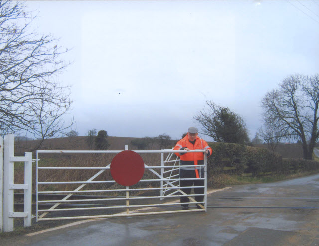
Image: © Stephen Craven Taken: 25 Feb 2006
A volunteer of the Wensleydale Railway opens the gates at Crakehall level crossing. There are no more than a few services per day passing, so it would not be economical to automate the crossing or have paid staff on duty.
Images are licensed for reuse under creativecommons.org/licenses/by-sa/2.0
Image Location
Latitude
54.298039
Longitude
-1.633967