Holbeam Farm entrance, Stalisfield ? converted to ?modern country living?
Introduction
The photograph on this page of Holbeam Farm entrance, Stalisfield ? converted to ?modern country living? by D Gore as part of the Geograph project.
The Geograph project started in 2005 with the aim of publishing, organising and preserving representative images for every square kilometre of Great Britain, Ireland and the Isle of Man.

There are currently over 7.5m images from over 14,400 individuals and you can help contribute to the project by visiting https://www.geograph.org.uk
Holbeam Farm entrance, Stalisfield ? converted to ?modern country living?
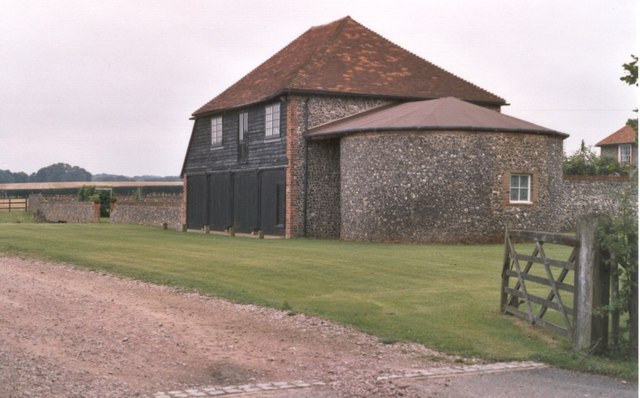
Image: © D Gore Taken: Unknown
From the 17th century, when my family of North Downs farmers had the lease of Holbeam Farm for some 60 years, the farm was owned by St Bartholomew’s Hospital in London – the doctors may still own it today. Judging by its surviving buildings, it was a substantial farm property. It had the advantage of fairly level ground for cultivation, not usual up on this part of the Downs (at 450 feet ASL), where farmers also have to contend with heavy clay soil laced with stones and stronger winds, severer weather and a shorter growing season than below in the valley. Thus in 1839 the Hospital owners rebuilt part of it and developed it as a model upland farm. Today, however, its grand old flint-walled buildings have been converted to modern draught-free ‘country living’. It has a neat but desolate air - sans crops, sans animals, sans mud, sans everything. But see the view Image See also the Gallery at: http://www.geograph.org.uk/gallery/trail_of_a_kentish_farming_family_9094 (background family story http://books.google.com/books?id=hrpS_YQ9FoAC&printsec=frontcover&dq=On+Kentish+Chalk )
Images are licensed for reuse under creativecommons.org/licenses/by-sa/2.0
Image Location
Latitude
51.254404
Longitude
0.823879