Railway bridge at Colwall - the chicane
Introduction
The photograph on this page of Railway bridge at Colwall - the chicane by Trevor Rickard as part of the Geograph project.
The Geograph project started in 2005 with the aim of publishing, organising and preserving representative images for every square kilometre of Great Britain, Ireland and the Isle of Man.

There are currently over 7.5m images from over 14,400 individuals and you can help contribute to the project by visiting https://www.geograph.org.uk
Railway bridge at Colwall - the chicane
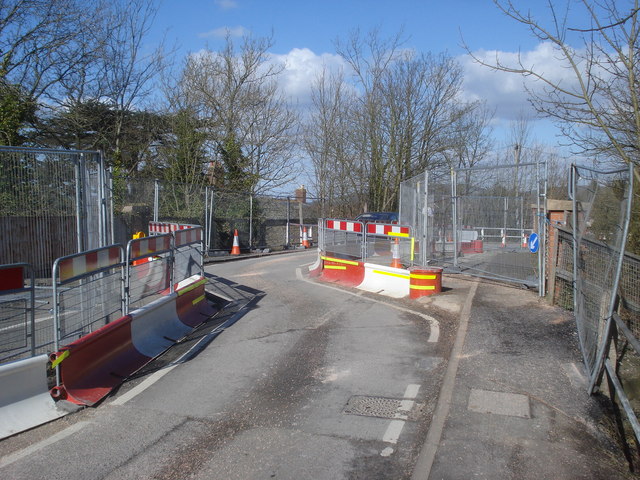
Image: © Trevor Rickard Taken: 4 Mar 2008
Looking across the bridge at what is now known as the 'chicane'. The bridge was totally closed for several months in 2007 when a council 'jobsworth' inspector deemed it unsafe. Closed virtually overnight without consultation, this led to local businesses being totally stressed as most rely on passing trade between Malvern and Ledbury. After many public protests a compromise led to this set-up, controlled by temporary traffic lights and not open to large vehicles. The route follows the stronger parts of the bridge, hence the chicanes at each end. This has led to many car scrapes because the bends are too tight. Fortunately, the bridge will now be fixed... http://www.herefordshire.gov.uk/council_gov_democracy/news/32112.asp http://www.bbc.co.uk/herefordandworcester/content/articles/2007/08/21/colwall_bridge_poem_feature.shtml http://www.herefordshire.gov.uk/council_gov_democracy/news/33465.asp
Images are licensed for reuse under creativecommons.org/licenses/by-sa/2.0
Image Location
Latitude
52.074265
Longitude
-2.365878