Broad Water, Great Livermere
Introduction
The photograph on this page of Broad Water, Great Livermere by Bob Jones as part of the Geograph project.
The Geograph project started in 2005 with the aim of publishing, organising and preserving representative images for every square kilometre of Great Britain, Ireland and the Isle of Man.

There are currently over 7.5m images from over 14,400 individuals and you can help contribute to the project by visiting https://www.geograph.org.uk
Broad Water, Great Livermere
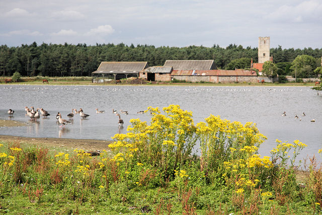
Image: © Bob Jones Taken: 1 Aug 2008
Hundreds of geese line the shore of Broad Water, a shallow flooded area between the two churches of Great and Little Livermere, and which forms part of Ampton Water. The church tower on the far side of the lake is the ruined church of Little Livermere Image
Images are licensed for reuse under creativecommons.org/licenses/by-sa/2.0
Image Location
Latitude
52.309824
Longitude
0.758256