Engine house at Porkellis
Introduction
The photograph on this page of Engine house at Porkellis by Rod Allday as part of the Geograph project.
The Geograph project started in 2005 with the aim of publishing, organising and preserving representative images for every square kilometre of Great Britain, Ireland and the Isle of Man.

There are currently over 7.5m images from over 14,400 individuals and you can help contribute to the project by visiting https://www.geograph.org.uk
Engine house at Porkellis
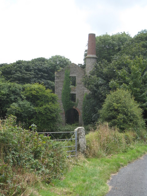
Image: © Rod Allday Taken: 2 Aug 2008
Although very well preserved this engine house is now completely surrounded by woodland. It served Tyacke's pump shaft, as part of Wheal Basset & Grylls, also known as Porkellis United Mine
Images are licensed for reuse under creativecommons.org/licenses/by-sa/2.0
Image Location
Latitude
50.151102
Longitude
-5.23004