Romford: The Rotunda
Introduction
The photograph on this page of Romford: The Rotunda by Nigel Cox as part of the Geograph project.
The Geograph project started in 2005 with the aim of publishing, organising and preserving representative images for every square kilometre of Great Britain, Ireland and the Isle of Man.

There are currently over 7.5m images from over 14,400 individuals and you can help contribute to the project by visiting https://www.geograph.org.uk
Romford: The Rotunda
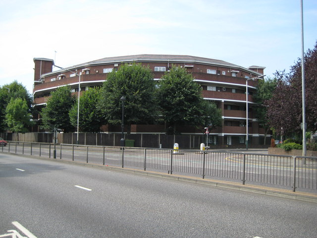
Image: © Nigel Cox Taken: 27 Jul 2008
Viewing this building on satellite imagery it looks like the old Wembley Stadium, but there is more than a hint that it is not quite symmetrical with the southern end wider than the northern. It is a residential block of flats and is viewed here looking across St Edwards Way, better known as the Romford Ring Road.
Images are licensed for reuse under creativecommons.org/licenses/by-sa/2.0
Image Location


Leaflet Map data © OpenStreetMap
Latitude
51.578049
Longitude
0.176334