Romford: Trinity Methodist Church
Introduction
The photograph on this page of Romford: Trinity Methodist Church by Nigel Cox as part of the Geograph project.
The Geograph project started in 2005 with the aim of publishing, organising and preserving representative images for every square kilometre of Great Britain, Ireland and the Isle of Man.

There are currently over 7.5m images from over 14,400 individuals and you can help contribute to the project by visiting https://www.geograph.org.uk
Romford: Trinity Methodist Church
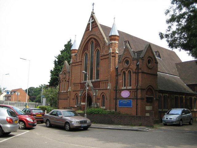
Image: © Nigel Cox Taken: 27 Jul 2008
This was an attempt to re-create a Francis Frith image from exactly 100 years ago http://www.francisfrith.com/search/england/essex/romford/photos/romford_59842.htm Unfortunately trees now obstruct the original view point and the Frith photograph was probably taken from a point which is now in the middle of the Romford Ring Road... As my better half pointed out to me the major visible change in the church since the 1908 photograph was taken is the fact that the surprisingly flamboyant and slender Rapunzel-style towers on either side of the main gable end have been considerably shortened since 1908. The foundation stone of the church was laid in 1887.
Images are licensed for reuse under creativecommons.org/licenses/by-sa/2.0
Image Location
Latitude
51.578115
Longitude
0.177636