Camperdown House
Introduction
The photograph on this page of Camperdown House by Mike Pennington as part of the Geograph project.
The Geograph project started in 2005 with the aim of publishing, organising and preserving representative images for every square kilometre of Great Britain, Ireland and the Isle of Man.

There are currently over 7.5m images from over 14,400 individuals and you can help contribute to the project by visiting https://www.geograph.org.uk
Camperdown House
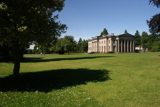
Image: © Mike Pennington Taken: 21 Jul 2008
In what is now Camperdown Country Park on the outskirts of Dundee. The estate formerly belonged to Lord Viscount Admiral Duncan and was named after his victory over the Dutch fleet at Camperduin, near Haarlem, in 1797. See Image
Images are licensed for reuse under creativecommons.org/licenses/by-sa/2.0
Image Location
Latitude
56.484263
Longitude
-3.043394