Beneath Several Layers of Tarmac
Introduction
The photograph on this page of Beneath Several Layers of Tarmac by Martin Addison as part of the Geograph project.
The Geograph project started in 2005 with the aim of publishing, organising and preserving representative images for every square kilometre of Great Britain, Ireland and the Isle of Man.

There are currently over 7.5m images from over 14,400 individuals and you can help contribute to the project by visiting https://www.geograph.org.uk
Beneath Several Layers of Tarmac
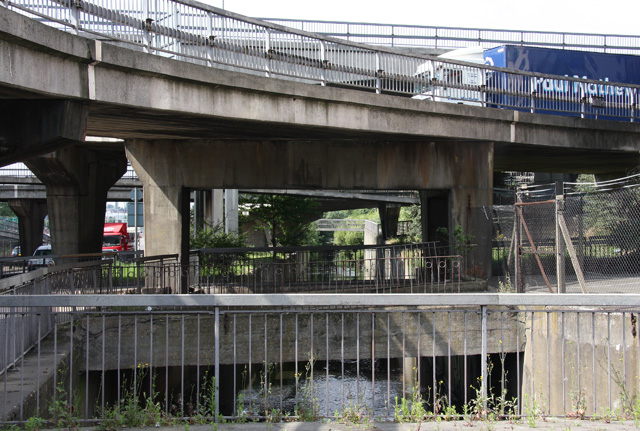
Image: © Martin Addison Taken: 26 Jul 2008
The River Brent continues beneath the junction of the A406 and A41. This photo is taken from the pedestrian area on the southwest side of Cooper Road. In the foreground is a disused concrete bridge that used to give access to the North Circular from what is currently Brent Cross Gardens. It probably dates back to the 1930's. Immediately above is a sliproad from the A41 giving access to the North Circular and to Brent Cross via Cooper Road. There is also a roundabout at this level, the opposite side of which can be seen through the arches on the left of the photo, where the North Circular itself is visible. Above and behind the white and blue truck on the sliproad is the bridge carrying through traffic on the A41.
Images are licensed for reuse under creativecommons.org/licenses/by-sa/2.0
Image Location
Latitude
51.577504
Longitude
-0.217847